Chapter 02 · 1513–1687
China Made Legible
China became legible through chains of translation, collaboration, and print.
Portuguese ships reached the Pearl River estuary in 1513, but contact did not produce instant understanding. Over the next century and a half, pilots, Chinese scholars, Jesuit missionaries, engravers, translators, publishers, and diplomats repeatedly converted local knowledge into new visual and textual forms.
Evidence set7 objects · 1584–1687
Method noteThe period begins with maritime contact in 1513; the visual sequence starts in 1584. That gap marks the slow conversion of encounter into durable, reproducible knowledge.
The evidence sequence
How China became an information system
Scroll through 4 surviving objects. The image changes as the argument advances from one frame to the next.
01 / Name
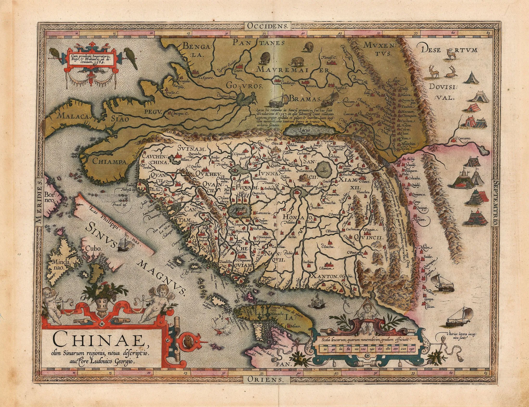
A name acquires borders
Published in Europe’s most influential atlas, Barbuda and Ortelius’s map gives “Chinae” a bounded body filled with provinces, rivers, cities, roads, mountains, and a prominent wall. Older names and reports remain, but the page makes them cohere as one territorial object.
Close readingWest is placed at the top. The Great Wall becomes a dramatic edge, while tents, animals, ships, and decorative figures turn reported geography into an atlas image designed to persuade as well as inform.
Open source record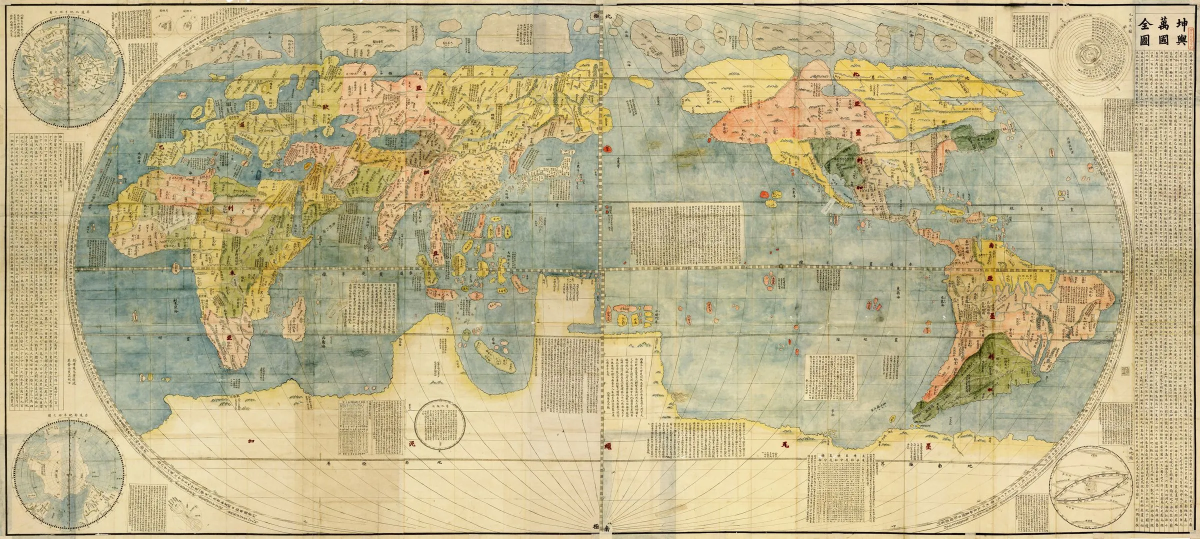
02 / Translation
The world speaks Chinese
Matteo Ricci’s world map was not simply a European object imported into China. Li Zhizao worked on the project and Zhang Wentao printed its six panels. Chinese text, Ming paper, woodblocks, and scholarly labour made a global projection usable within a Chinese reading world.
Close readingChina sits near the visual centre, while more than a thousand place names and long explanatory notes surround the continents. The map joins Renaissance projection to Chinese language and print practice; neither side alone explains the object.
Open source record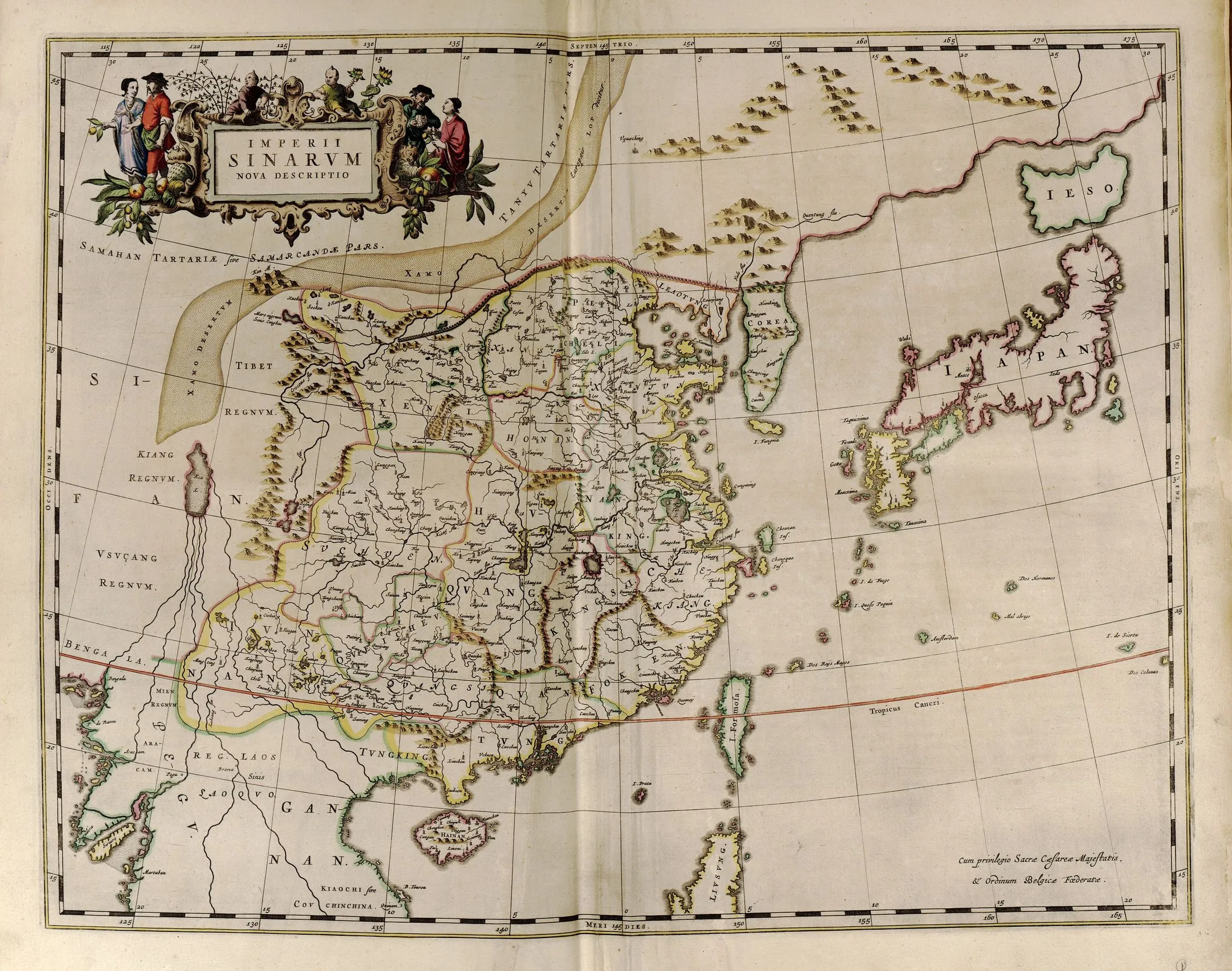
03 / Provinces
An empire becomes an atlas
Martino Martini and Joan Blaeu recast Chinese territorial knowledge into the visual grammar of the Dutch atlas. A general map and provincial sheets made the empire appear internally ordered, comparable, and available for repeated consultation.
Close readingColoured boundaries, latitude and longitude, river systems, provincial names, and a European cartouche coexist. The confident surface hides the work of translating Chinese maps and gazetteers into another cartographic system.
Open source record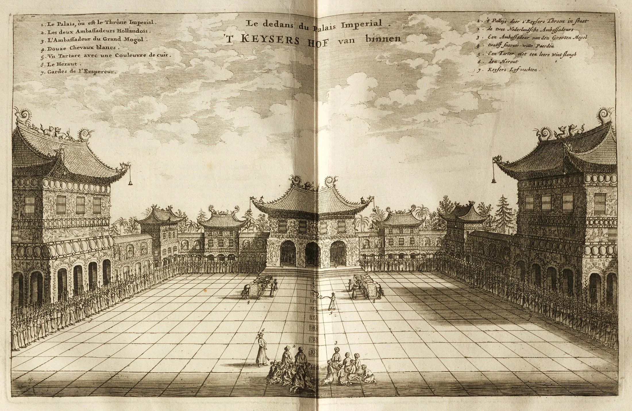
04 / Eyewitness
Observation becomes a market
Johan Nieuhof travelled with the Dutch embassy of 1655–1657 and kept notes and drawings. In Amsterdam, Jacob van Meurs’s workshop turned that material into a lavish bestseller whose images let readers imagine cities, ceremonies, buildings, and bodies across China.
Close readingThe print numbers diplomats, horses, heralds, and guards as if documenting a witnessed scene. Its symmetrical palace and theatrical depth also reveal the publisher’s hand: “from life” was a commercial claim, not a guarantee of transparency.
Open source recordCounter-reading
Legibility is not transparency
These objects made China easier for European readers to organize. They also selected, reformatted, and sometimes obscured the people and systems that produced their authority.
- 01European names and atlas conventions standardised a geography that had entered print through many languages and routes.
- 02Chinese scholars, printers, maps, gazetteers, and intermediaries supplied essential knowledge but were often compressed into European authorship.
- 03Mission, diplomacy, and commerce determined what counted as useful detail; maps and “eyewitness” images were never neutral containers.
Evidence register
Sources in this chapter
- 01Chinae, olim Sinarum regionis, nova descriptioLuis Jorge de Barbuda; published by Abraham Ortelius1584Bounded and named territory
- 02Kunyu Wanguo QuantuMatteo Ricci with Li Zhizao; printed by Zhang Wentao1602A world translated into Chinese
- 03Imperii Sinarum nova descriptioMartino Martini; published by Joan Blaeu1655Empire divided into provinces
- 04The interior of the Imperial CourtAfter Johan Nieuhof; engraved and published by Jacob van Meurs1665Diplomatic encounter staged for print
- 05Wanguo QuantuGiulio Alenicirca 1623Adaptation and circulation
- 06Frontispiece to China IllustrataAthanasius Kircher and an unidentified engraver1667Knowledge enlisted for mission
- 07The life of Confucius in LatinProspero Intorcetta, Philippe Couplet, Christian Herdtrich, François de Rougemont, and collaborators1687Chinese philosophy translated for Europe