Chapter 01 · 1275–1412
Cathay Before “China”
Cathay was built from circulation before encounter.
European readers did not receive a single, stable portrait of China. They received names, itineraries, marvels, and reports of imperial power—copied, translated, illustrated, and placed on maps long after the journeys they described.
Evidence set3 objects · 1375–1410
Method noteThe chapter begins in 1275, but its surviving visual witnesses are later. Their distance from the journey is part of the evidence.
The evidence sequence
How a distant place became visible
Scroll through 3 surviving objects. The image changes as the argument advances from one frame to the next.
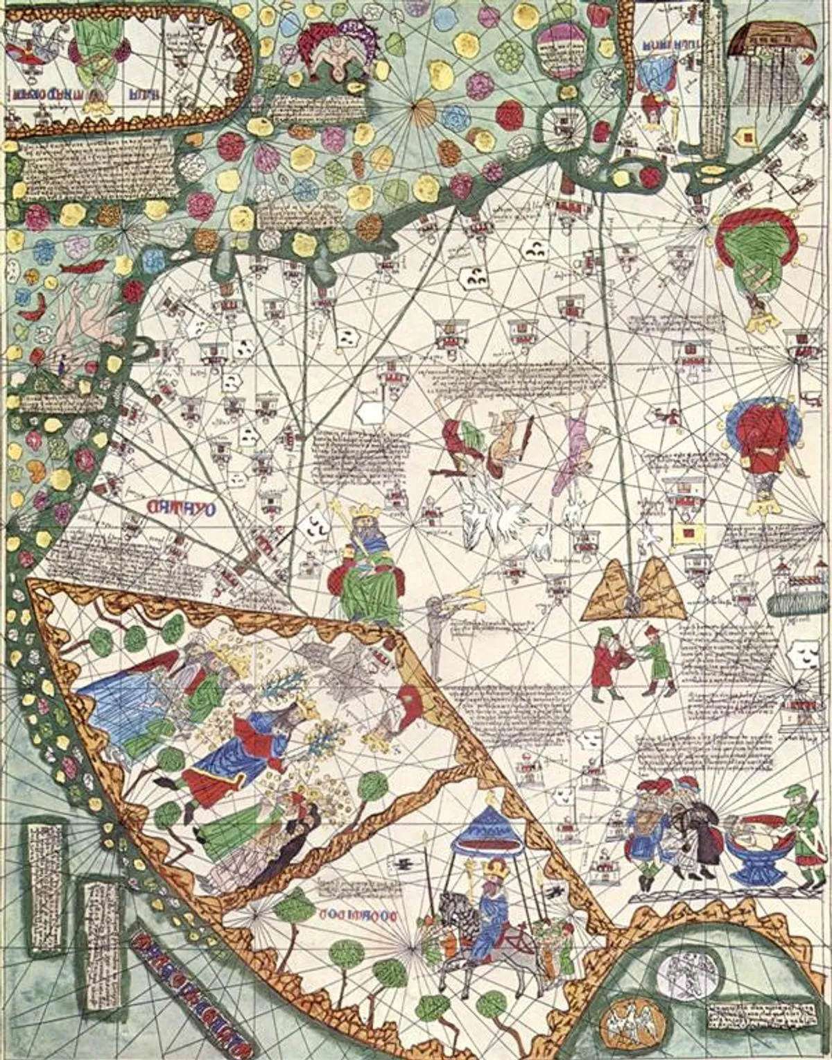
01 / Map
A name becomes a place
In the Catalan Atlas, East Asia is not an empty edge. Ports, rulers, animals, routes, and blocks of text make the region densely knowable. “Catayo” enters a world drawn for navigation, trade, devotion, and political curiosity.
Close readingThe sheet faces south at the top. Its apparent precision combines portolan geometry with reported and imagined interiors; the map is an argument about connection, not a neutral survey.
Open source record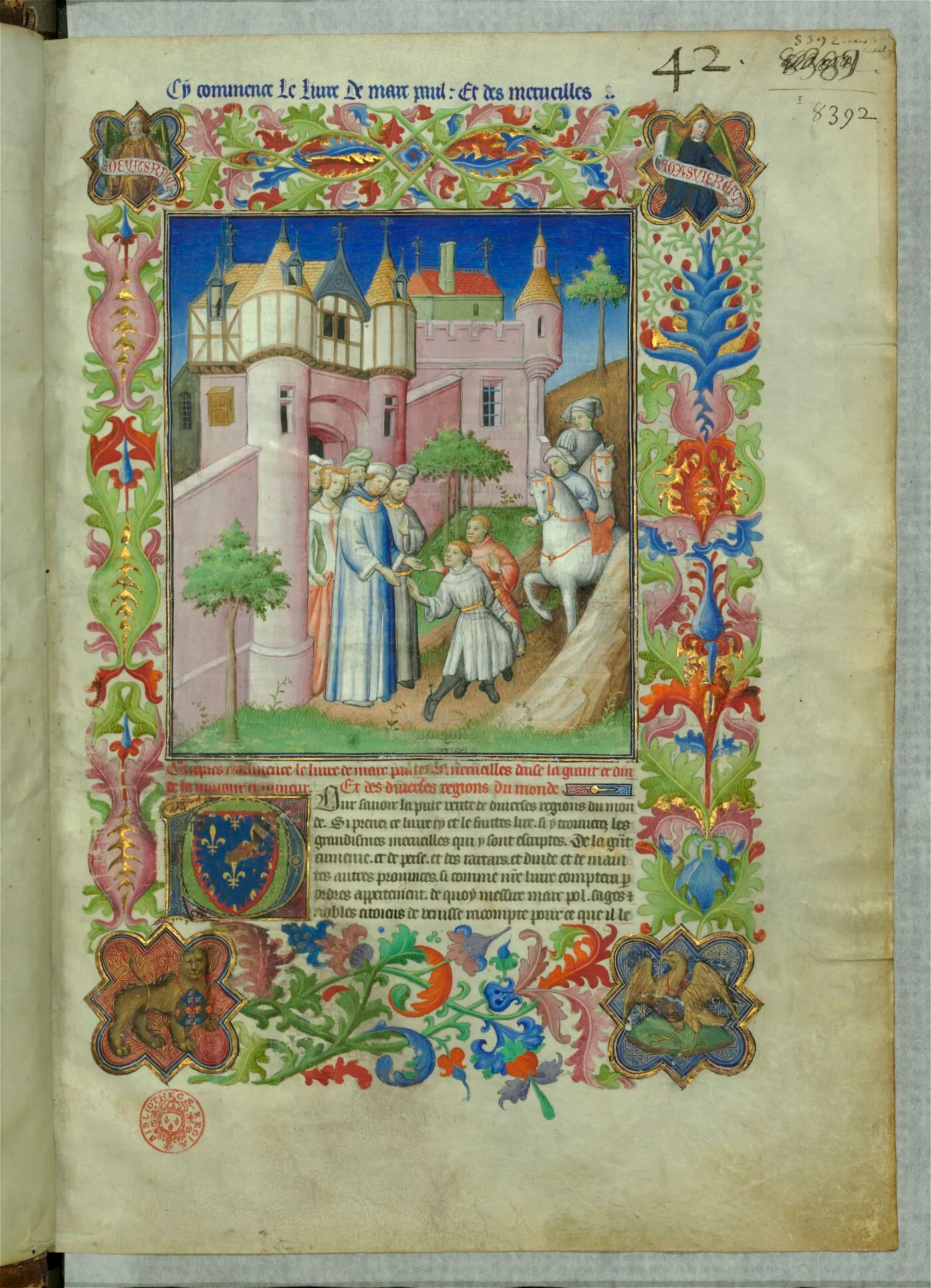
02 / Manuscript
A report acquires authority
More than a century after Marco Polo’s journey, his account appears inside a lavish Parisian compilation made for an elite patron. The decorated opening turns travel testimony into a collectible, courtly object.
Close readingThe image does not show Cathay. It shows how knowledge about distant places gained weight through costly materials, compilation, illumination, and ownership.
Open source record
03 / Court
Power becomes spectacle
Kublai Khan rides beneath a canopy carried by elephants, surrounded by horses, attendants, and falcons. Scale and abundance translate distant sovereignty into a visual language a European court could recognise.
Close readingThis is not Marco Polo’s eyewitness sketch. Parisian illuminators pictured Mongol rule generations later, using familiar conventions to make an unfamiliar empire legible.
Open source recordCounter-reading
Read the distance, not just the detail
These objects reveal what Cathay could mean in Europe. They do not provide an unmediated view of Yuan China.
- 01Later copies preserve a journey while also rewriting its emphasis.
- 02Familiar European visual conventions shape how foreign power appears.
- 03“Cathay” names a moving geography, not a timeless national identity.
Evidence register
Sources in this chapter
- 01East Asia in the Catalan AtlasAbraham Cresques or his workshop1375Mapped and connected world
- 02Opening of the Livre des merveilles du mondeParisian illuminators working for John the Fearlesscirca 1410–1412Authority through compilation
- 03Kublai Khan huntingParisian illuminator of BnF Français 2810circa 1410–1412Imperial power as spectacle